
ES · EN
Contact us
Digitisation and automation of urban asset management. It combines data from mobile and fixed platforms, cameras, LiDAR, GPS and other sensors with 2D/3D perception, turning urban routes into structured, georeferenced inventories.
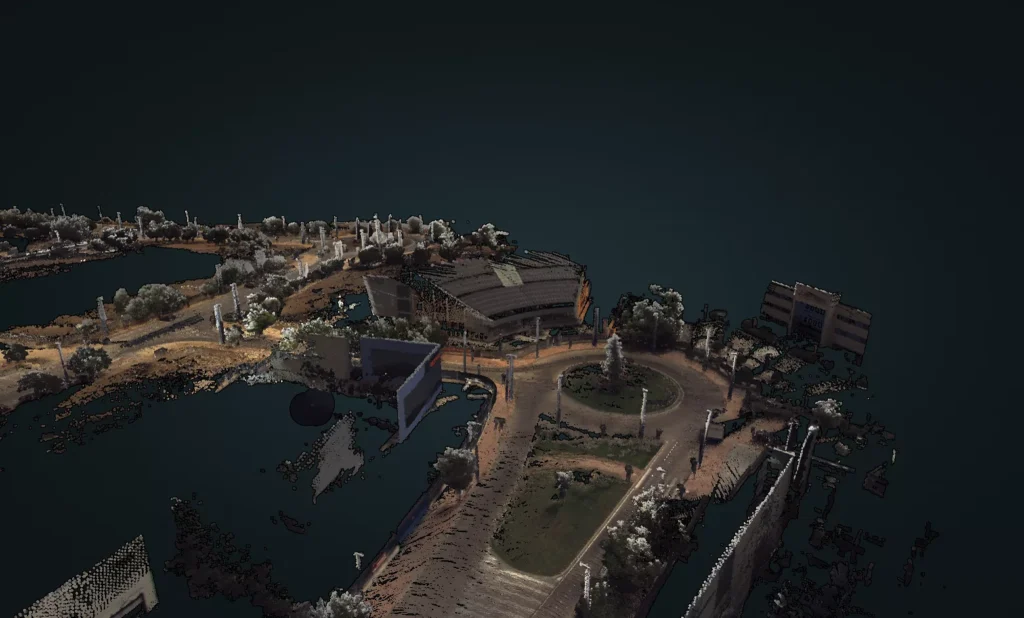
Capture happens on the vehicle and analysis on the server, so inspection campaigns can be reprocessed and use cases added on data already recorded.
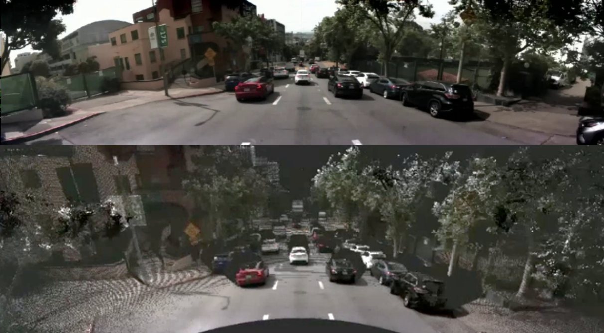
LiDAR, cameras and RTK-corrected GNSS, synchronised on the vehicle.
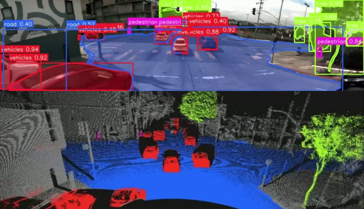
Every asset detected and classified in the image and in the point cloud.
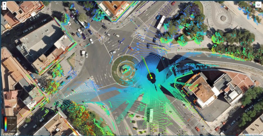
Image, LiDAR and GNSS fused in absolute coordinates.
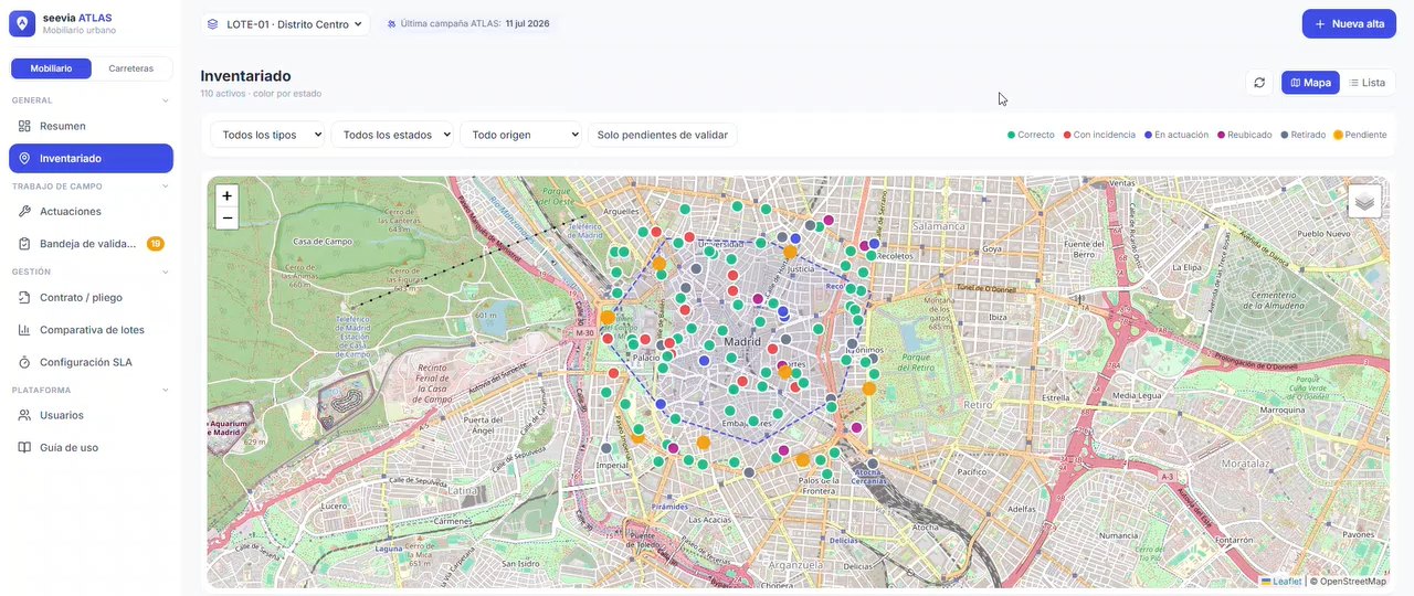
Inventory in the web platform, in your GIS or via API.
ATLAS does not depend on the asset: different modules work on the same capture. These are some of them.
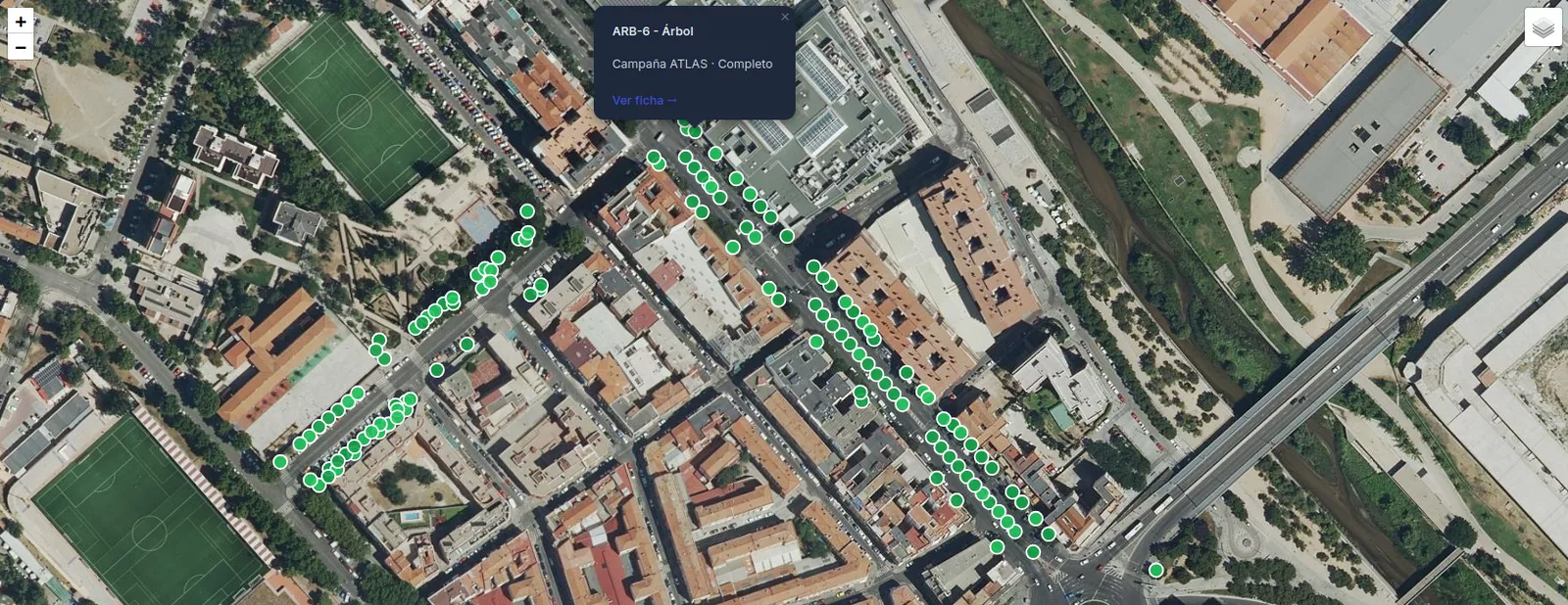
Street furniture, signage and road elements, located on the map with their record and condition.
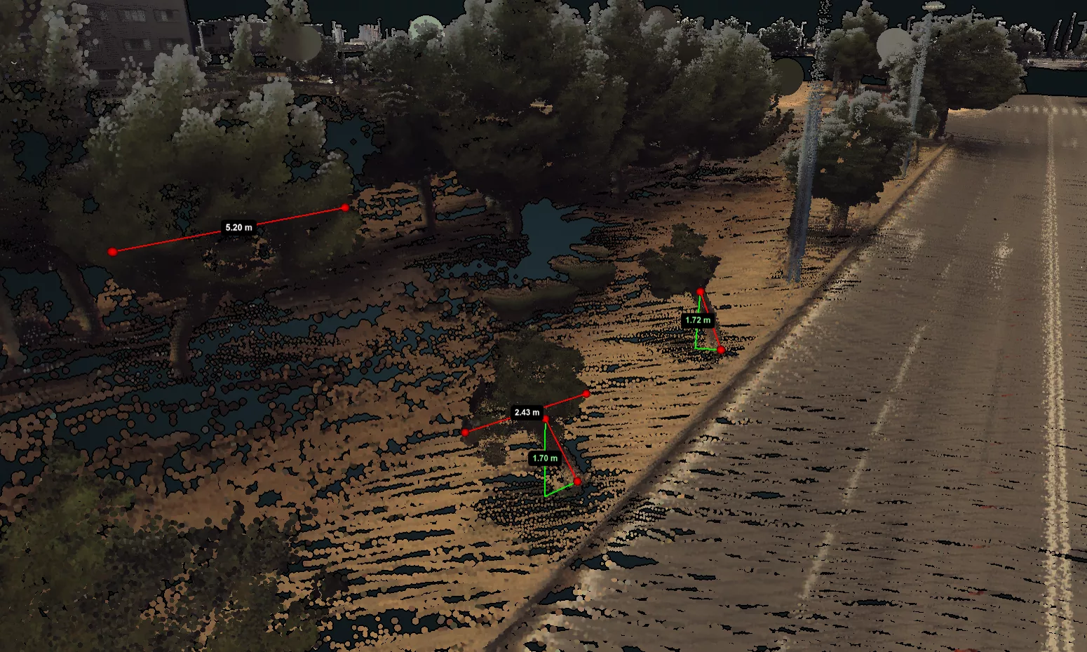
Trees and empty tree pits located, with height, trunk and crown, cross-checked with your inventory.
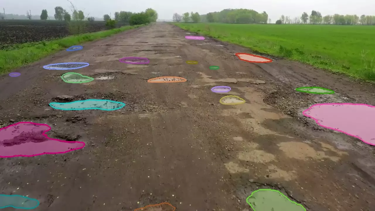
Potholes and pavement damage, measured and located, and the road's readiness for automated driving.
We design the module you need, and it also applies to the captures you already have.
Seevia ATLAS mobile platform
Cameras, LiDAR, RTK-corrected GNSS and IMU, chosen for each inspection campaign
Stable sources
Cartography and surveys · manual measurements · satellite and weather data
Active infrastructure
Counters at key points · signage and connected beacons
Perception
LiDAR and image detection software.
Localisation
RTK-corrected GNSS, LiDAR and IMU.
Data
Sensor data fusion and source aggregation, business indicators and predictive models. Offline processing, on the server.
Urban elements
Trees, street furniture and roads, with condition tracking.
Road
Road condition information and AD readiness assessment.
Data and metrics
List of assets, incidents and actions; detailed information on each asset.
Management
Planning, execution and closure of actions; contract monitoring and cost forecasting.
Integration
With GIS and third-party APIs.
Formats
CSV · GeoJSON · Shapefile; web platform and APIs.
Field team
Control screen · real-time diagnostics · geofencing · remote monitoring over 4G or 5G.
Service
Installation and start-up · calibration · training · preventive, corrective and evolutionary maintenance.
Data protection
People and vehicles blurred on the vehicle before storage · encrypted storage · only the data needed · restricted access.
AI Act
Minimal-risk system under Regulation (EU) 2024/1689.
Options
Projects, pilots, proofs of concept, licences of use and SaaS.