
ES · EN
Contact us
From image to position
The camera recognises and LiDAR measures. With camera-LiDAR fusion we detect in low light, at distance and on the move. We turn each detection into an object with position, type and track, in vehicles and fixed cameras.
Perception is knowing what is around and where. In 2D, a neural network recognises cars, people or containers in the image. In 3D, using a LiDAR's point cloud, it places them in space without colour. Fusion joins both and tracking keeps each object's identity across frames.
A camera alone fails in low light, glare or dirty windshields. A LiDAR measures shape and distance, but not colours or road signs. Neither is enough alone, and two sources with shared calibration see together what neither sees alone.
Illustrative diagram
01
Cameras and LiDAR share a clock and calibration.
02
We clean and prepare each sensor's data before analysing it.
03
Our own software detects in images and point clouds and combines both.
04
Each object has a unique ID and is processed on the device itself, in the vehicle or next to the camera.
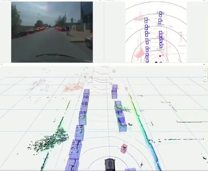
Camera, bird's-eye view and 3D scene in sync.
Yes, within margins that are checked in each project with real data.
Yes. Detection is adapted to the objects or situations that matter to you.
No. Analysis is done on the device itself and data comes out.
Tell us your case and we will look at it with your data.
Next
Localisation and maps